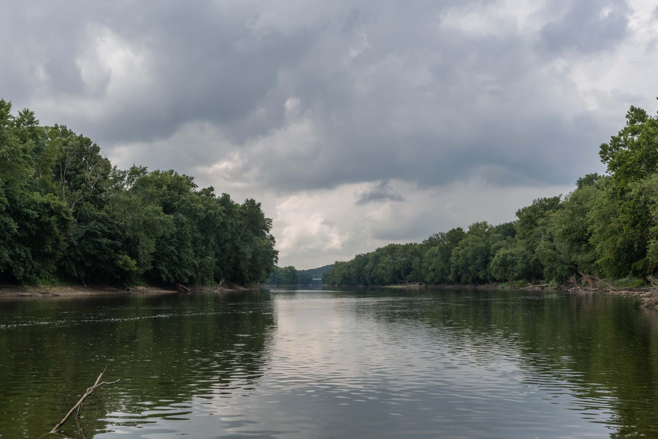
Indiana built its identity on rivers. Early settlers followed the Wabash and Ohio inland from the east. Traders moved goods on flatboats before railroads existed. Towns sprang up where rivers met, where ferries crossed, and where mill dams could generate power.
The state sits between two major water systems. The Great Lakes influence reaches down from the north through rivers like the Maumee. Big river country dominates the south, where the Ohio carves the border with Kentucky. Northern counties have flatter ground with rivers flowing toward Lake Erie. Central areas hold rolling farmland cut by the White River system. Southern Indiana gets hillier with limestone bluffs and deeper valleys carved by centuries of water flow. Mossy Oak Properties connects buyers with Indiana Waterfront Properties for Sale that include river access, bottomland, and forested corridors perfect for outdoor use. Below are the major rivers that truly shape the Hoosier landscape.
1. Wabash River – Indiana’s Lifeline
- Length: 503 miles total.
- Route: Fort Recovery, Ohio, to the Ohio River via Huntington, Lafayette, and Terre Haute.
- Free-flowing: 411 miles with no dams from Huntington downstream.
- Wildlife: 150 fish species, numerous endangered plants and animals.
The Wabash drains most of Indiana and earned status as the official state river. The name comes from a Miami word meaning “water over white stones,” referencing limestone riverbed that used to show through clear water. French explorers mapped it in the 1600s and used it as a trade corridor between Canada and Louisiana.
The river widens from 200 feet at Huntington to 1,200 feet at its mouth. Depth ranges from less than five feet in the upper reaches to 30 feet in the lower 50 miles. Fertile bottomland runs along much of the Wabash, supporting farms and wildlife habitat. Riverfront tracts draw buyers looking for hunting ground, recreational property, or productive farmland with timber and water access.
2. White River – The Heart of Central Indiana
- Length: 362 miles total across West Fork and East Fork.
- Major cities: Indianapolis, Bloomington, Muncie, Anderson, Seymour.
- Watershed: 11,305 square miles entirely within Indiana.
- Water supply: Serves 2 million people.
The West Fork starts near Winchester and flows through Muncie and Anderson before reaching Indianapolis. The river turns southwest below the capital and continues toward the Wabash. The East Fork forms at Columbus, where the Driftwood and Flatrock rivers meet.
The Miami people called the West Fork “Wapahani,” meaning white sands. Smallmouth bass fishing draws anglers to both forks. Canoeists and kayakers paddle sections from Anderson down through Spencer and Martinsville. Prime rural properties and timber tracts near Bloomington and Martinsville attract outdoor buyers looking for river access combined with privacy and hunting opportunities.
3. Ohio River – The Mighty Southern Border
- Length: 981 miles from Pittsburgh to Cairo, Illinois.
- Indiana border: Forms the entire southern boundary.
- Major cities: Evansville, New Albany, Madison, Jeffersonville.
- Fisheries: Blue catfish, striped bass, smallmouth bass, sauger.
The Ohio forms where the Allegheny and Monongahela rivers meet at Pittsburgh. It flows northwest out of Pennsylvania, then southwest along the Indiana-Kentucky border before meeting the Mississippi at Cairo. The river marked boundaries between free and slave states before the Civil War.
Evansville became the largest city on Indiana’s stretch of river, handling coal, steel, and manufactured goods. The Ohio carries more water to the Mississippi than any other tributary. Commercial barges still move millions of tons of cargo annually. Waterfront acreage and recreational tracts along the Indiana side offer investment potential and tourism opportunities, particularly near historic river towns.
4. Maumee River – Northern Gateway to the Great Lakes
- Length: 137 miles from Fort Wayne to Lake Erie.
- Formation: The St. Joseph River (of the Maumee watershed) and the St. Marys rivers meet in Fort Wayne.
- Destination: Flows northeast into Ohio, empties into Lake Erie.
- History: Controlled by Miami people at strategic portage point.
The Maumee connects Indiana’s northeast to the Great Lakes system. Fort Wayne grew at the confluence where Native Americans controlled a portage between the Maumee and Wabash watersheds. This strategic point lets traders move between the Great Lakes and the Mississippi River systems.
The river supports walleye and smallmouth bass fishing. Kayakers and canoeists paddle stretches through Allen and DeKalb counties. Birders visit during spring and fall migrations when waterfowl use the river corridor. Land near Fort Wayne with Maumee River access draws regional buyers looking for fishing spots, small recreational tracts, and weekend properties within reach of urban amenities.
5. Tippecanoe River – One of America’s Natural Treasures
- Length: 182 miles through northern Indiana.
- Route: Crooked Lake near Angola to the Wabash near Lafayette.
- Recognition: Named among the most ecologically important rivers in the United States.
- Recreation: Canoeing, tubing, fishing, camping.
The Tippecanoe earned recognition for outstanding water quality and intact natural character. The river starts at Crooked Lake in Noble County and winds southwest for 182 miles before meeting the Wabash at Prophetstown State Park. The confluence marks the site of the 1811 Battle of Tippecanoe, where Governor William Henry Harrison defeated Tecumseh’s forces.
Clear water and stable temperatures support diverse fish populations. Canoeists paddle through wooded corridors with sandbars and riffles. The river maintains a natural flow pattern without major dams for most of its length. Riverfront cabins and forested recreational property along the Tippecanoe stay in high demand from buyers who want quality fishing and paddling access combined with natural surroundings and wildlife habitat.
6. St. Joseph River – Flowing Through History and Community
- Length: 210 miles crossing Michigan and Indiana.
- Major cities: South Bend, Mishawaka, and Elkhart.
- Features: Multiple hydropower dams and urban river parks.
- Recreation: Boating, kayaking, fishing.
The St. Joseph River loops through southwestern Michigan and northern Indiana before emptying into Lake Michigan. The river powered mills and industry as South Bend and Elkhart developed. Multiple dams generate hydroelectric power and create pools for recreation.
Smallmouth bass, rock bass, and panfish inhabit the St. Joseph. Paddlers launch from multiple access points through Elkhart, Mishawaka, and South Bend. The river corridor provides green space and trails in developed areas. Property along the St. Joseph includes a suburban-rural mix where buyers find river access near northern Indiana towns.
7. Blue River – Southern Indiana’s Hidden Gem
- Length: 57 miles.
- Counties: Washington, Crawford, and Harrison.
- Features: Limestone bluffs, caves, springs, pristine water.
- Recreation: Paddling, trout fishing, camping, cave exploration.
Blue River cuts through southern Indiana’s karst landscape, where limestone creates caves, sinkholes, and springs. The river starts near Salem and flows south through rugged terrain before joining the Ohio River. Clear spring-fed water stays cool enough in places to support stocked trout.
Paddlers navigate through rock gardens and small rapids during higher water. Limestone bluffs rise along sections of the river, creating scenic views. The surrounding forest supports deer, turkey, and small game. Recreational and hunting tracts with creek or river frontage in Washington and Crawford counties appeal to buyers looking for privacy, natural beauty, and spring-fed water access in southern Indiana’s hill country.
Your Place Along Indiana’s Rivers with Mossy Oak Properties
Indiana’s rivers created the landscape that farmers, hunters, and outdoor buyers value today. Bottomland along the Wabash grows crops and holds whitetail deer. Wooded slopes above the White River provide turkey habitat and timber value. Limestone banks along the Blue River offer scenic retreats far from crowds.
Mossy Oak Properties works throughout Indiana, connecting buyers with riverfront Indiana Land For Sale that matches their goals. The company operates across more than 30 states with local agents who understand Indiana’s river systems, property values, and outdoor markets. We help people find Wabash bottomland farms, wooded retreats along the White River, and recreational tracts near southern Indiana’s smaller waterways. Contact Mossy Oak Properties to start looking at land with river access across Indiana.
References:
- https://www.in.gov/dnr/fish-and-wildlife/wildlife-resources/state-wildlife-action-plan/ecosystems/rivers-and-streams/
- https://www.nature.org/en-us/about-us/where-we-work/united-states/indiana/stories-in-indiana/wabash-river/
- https://www.britannica.com/place/White-River-Indiana
- https://www.orsanco.org/
- https://www.americanrivers.org/river/maumee-river/
- https://www.in.gov/dnr/state-parks/recreation/water-trails/scenic-river-system/indianas-natural-scenic-and-recreational-river-system-blue-river/
- https://watershedfoundation.org/about/our-land-and-lakes/